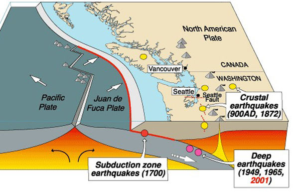
The spectacular geography of the Pacific Northwest is dominated by plate tectonics. The North American plate is moving westward, colliding with and sliding over the Juan de Fuca plate. The area where the two plates meet is referred to as the Cascadia Subduction Zone and stretches 700 miles from Northern California to British Columbia. The geography of the Olympic Mountains, Puget Sound, and the Cascade Mountains are all caused by this meeting of plates. Earthquakes and volcanism are both products of this ongoing process which is common around the “Ring of Fire” surrounding the Pacific Ocean.
Geological evidence indicates that great earthquakes (> magnitude 8.0) may have occurred sporadically at least seven times in the last 3,500 years, suggesting an average interval of about 500 years.The last known great earthquake in the northwest was the 1700 Cascadia earthquake which has been dated to Jan 26th, 1700.
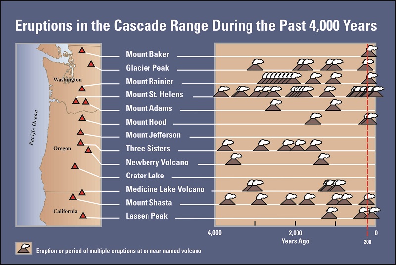
Cascade Volcanoes
Geologists believe that the Cascade mountain range is about 40 million years old. Many volcanoes have come and gone in the Cascade range, with each volcano active for approximately 2 million years. The nearest volcano, Mt Rainier, is thought to be about ½ million years old.
Mt Rainier has erupted many times in the past, with the most recent being in the mid and late 1800’s. There are four main hazards during an eruption: ash, pyroclastic flow, lava, and lahars. For Puyallup, the most dangerous of these is the possibility of a lahar. A lahar is a violent type of mudflow or debris flow composed of a slurry of pyroclastic material, rocky debris and water created by a volcanic eruption or landslide that can travel along river valleys for dozens of miles. The City of Puyallup has created an Emergency Management website.
Cascade Volcanic Eruptions
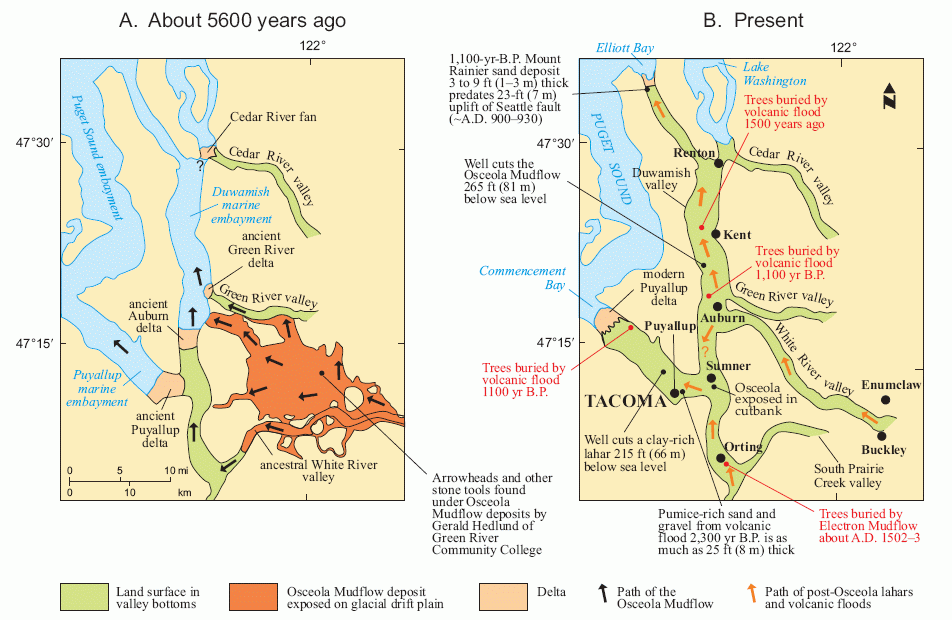
Osceola Lahar
The lands under the cities of Tacoma and Puyallup were once under water as parts of Puget Sound. One particular MAJOR eruption of Mt Rainier approximately 5600 years ago resulted in the Osceola Mudflow, or Lahar. The Osceola Lahar flowed down the White river valley to fill in parts of Puget Sound and create the land under the City of Puyallup.
In total, Osceola deposits cover an area of about 212 sq miles in the Puget Sound lowlands, extending at least as far North as the Seattle suburb of Kent, and South to Commencement Bay, the site of the Port of Tacoma. The communities of Orting, Buckley, Sumner, Puyallup, Enumclaw, and Auburn are also wholly or partly located on top of deposits of the Osceola Mudflow. Geologic evidence in the form of buried trees suggests additional Lahars in the Puyallup Valley 500, 1100 and 1500 years ago.